
Step 1: Pacing Guides - Creating the MSIP Schedule
Step 2: Mars Image Analysis - Learn About the Red Planet
Step 3: Question Mars - Developing the Research Question
Step 4: Proposal - Developing the Research Plan
Step 5: Targeting - Imaging Mars
Step 6: Symposium and Technical Reporting
 Mars Image Analysis
NEW - NGSS and CCSS Designed and Aligned!
Mars Image Analysis is the centerpiece of the Mars Student Imaging Project. Students will build 21st Century Skills in this newly aligned and redesigned NGSS (Next Generation Science Standards) and CCSS (Common Core State Standards) activity. Educators and MSIP team leaders will achieve the following goals in implementation of this lesson.
To:
1. help students develop strong, scientific observation skills, moving them away from everyday observations;
2. develop scientific content knowledge regarding geologic features and relative age dating principles;
3. reinforce or introduce the evidence and claim cycle;
4. begin to understand much of our knowledge of planetary bodies is through images of the surface;
5. develop an interest in Mars that leads to a research topic for the Mars Student Imaging Project; and
6. building background knowledge and research skills using a particular Mars area of research.
Included below is a PowerPoint Presentation guiding the first few exploratory phases of the Mars Image Analysis lesson. Educators and MSIP team leaders are welcome to download and edit this document to fit their classroom style and speaker notes have been included to aide the facilitator during the lesson. The THEMIS Image Set Gallery will link you directly to a visual gallery of the THEMIS Image set used in correlation with the Mars Image Analysis lesson. Your MSIP coordinator will discuss this image set during your project orientation session.
Lesson last updated: May 2014
Download the grade appropriate Alignment Document:
 Mars Image Analysis MS Alignment Document
Mars Image Analysis HS Alignment Document
Download the grade appropriate Lesson:
Mars Image Analysis MS Lesson
Mars Image Analysis HS Lesson
Download additional materials:
To Download the THEMIS Image Set for the Mars Image Analysis activity, please use this link:
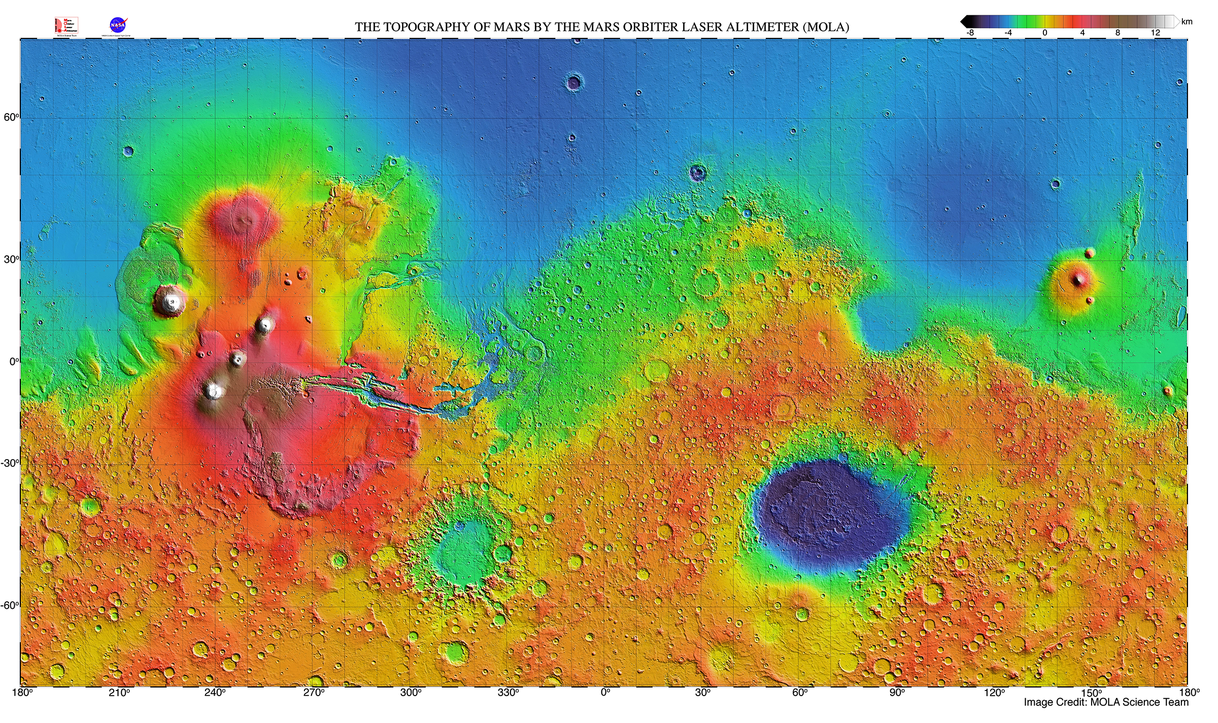
Click on the link below to open the MOLA map.
To view even more Mars images, go to the THEMIS Image Gallery on the THEMIS camera website. Use link below and click on THEMIS Images by Topic.
 Back
Back 